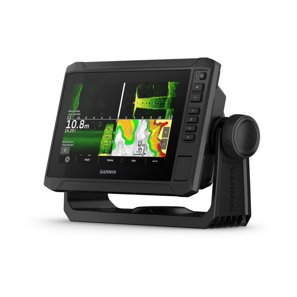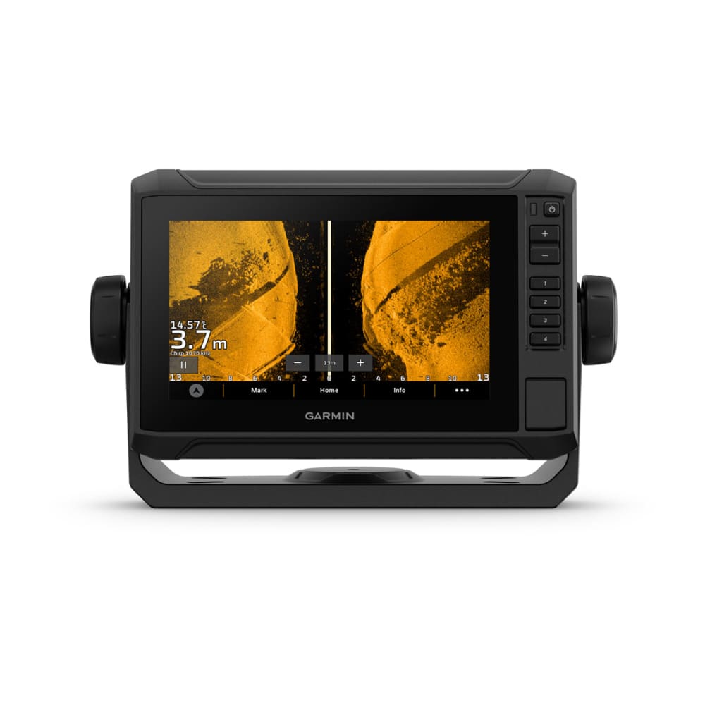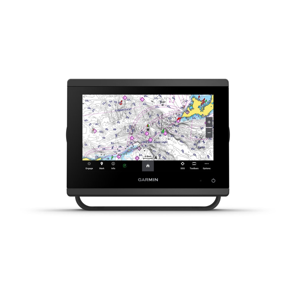


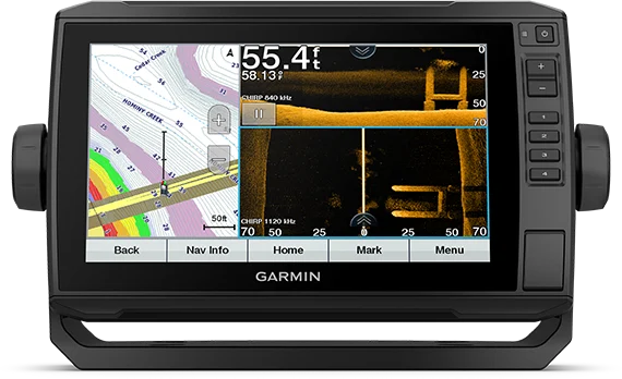
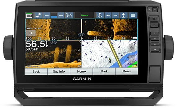
Echomap UHD2 Touch 95sv Chartplotter
What's in the box?
- ECHOMAP UHD 95sv with BlueChart g3 for U.K. and Ireland
- 8-pin transducer to 12-pin sounder adapter cable
- Charging/data cable
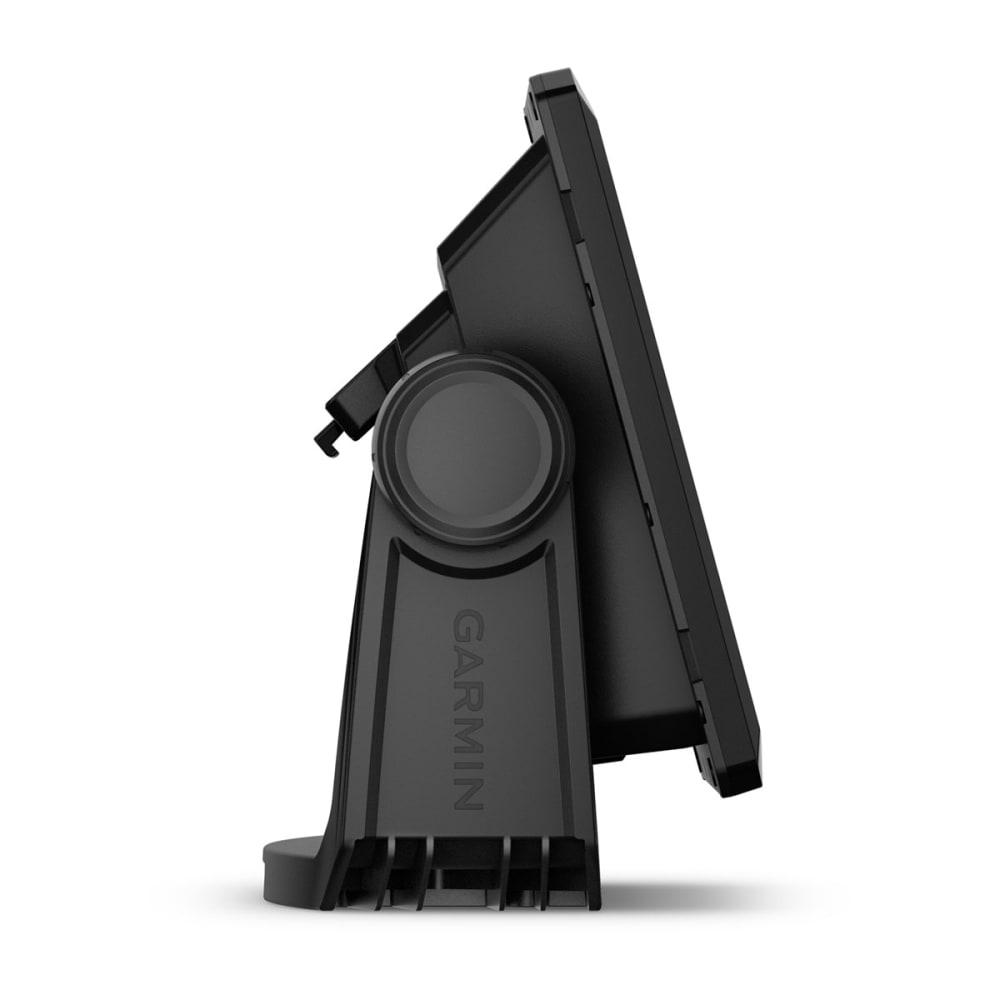
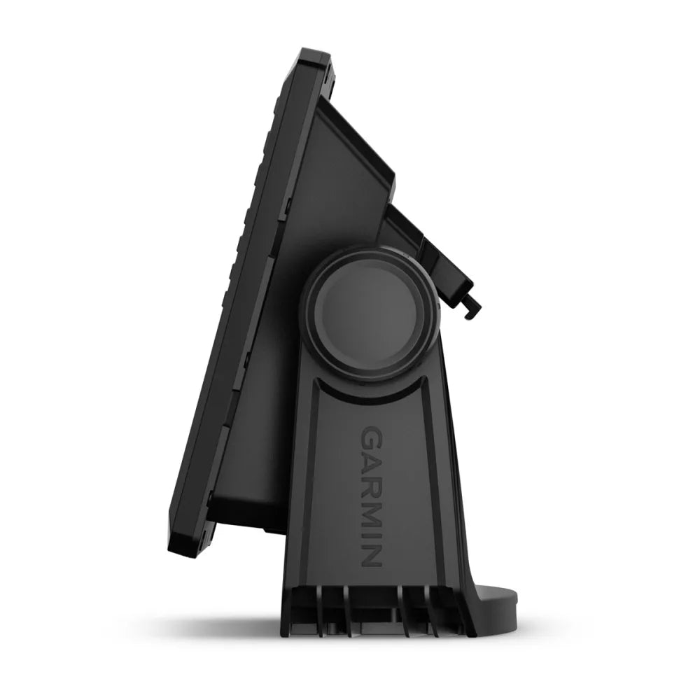
- Tilt/swivel mount with quick release cradle
- Flush mount
- Protective cover
- Hardware
- Documentation
Join The Club. Find More Fish
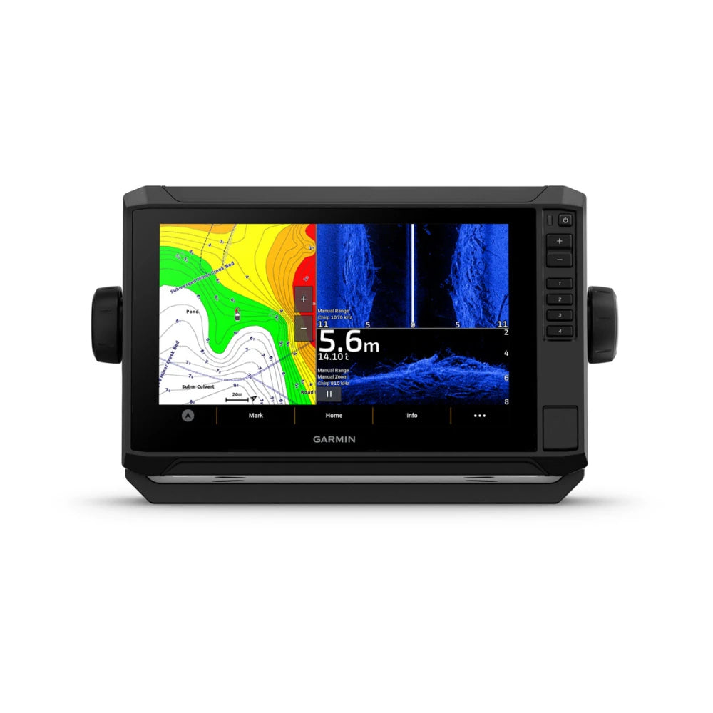
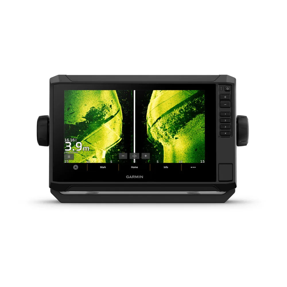
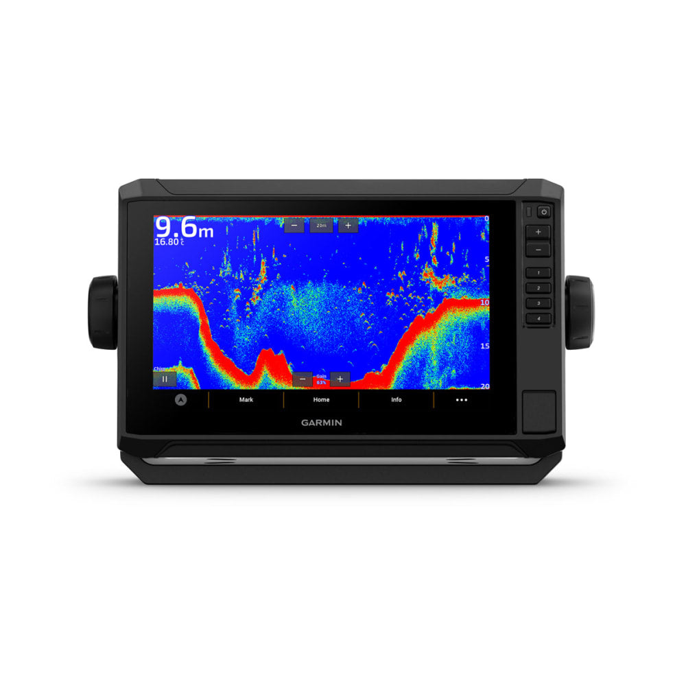
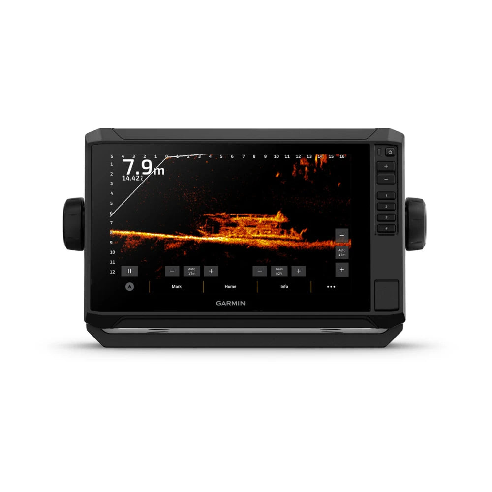
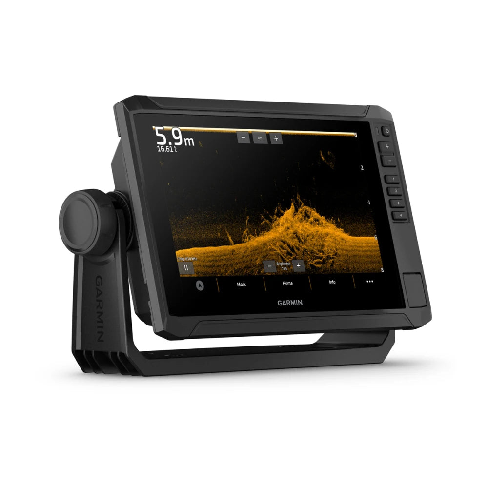
The sunlight-readable 9” touchscreen chartplotter features a quick-release bail mount, and the transducer bundle adds Ultra High-Definition scanning sonar and CHIRP traditional sonar.


Sonar Support
This chartplotter supports a variety of Garmin transducers (sold separately), including the Panoptix LiveScope™ scanning sonar system, which lets you see all around your boat in real time.
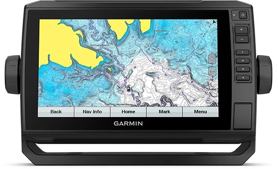
Preloaded Mapping
Experience unparalleled coverage and detail with preloaded Navionics+ charts for the United Kingdom, Ireland and Northwest mainland Europe coast featuring integrated Garmin and Navionics®content.

Network Capable
If you have multiple compatible ECHOMAP UHD or ECHOMAP Ultra devices on your boat, you can share information — such as sonar, user data and charts — among them (7” and 9” models only).
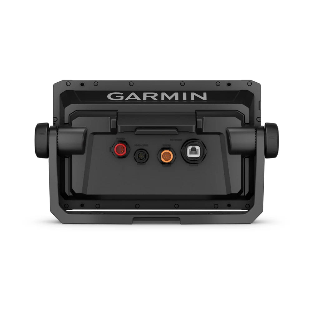
NMEA 2000® and NMEA 0183 Networks
Connect to autopilots, digital switching, weather, FUSION-Link™ audio system, media, VHF, AIS and more from one screen.
ActiveCaptain® App
Built-in Wi-Fi®connectivity pairs with the free all-in-one mobile app for access to the OneChart™feature, smart notifications1, software updates, Garmin QuickDraw Community data and more.
Force™ Trolling Motor Compatibility
Take control of the most powerful and efficient trolling motor available, route it to waypoints, follow tracks and more from the screen of your chartplotter.

Specifications
General
26.3 x 16.5 x 6.5 cm
1.0 kg
IPX7
✓
WVGA Display
19.9 x 11.3 cm; 22.9 cm (9.0") diagonal
400 x 800 pixels
Bail or flush
Touchscreen with Keyed Assist
Maps & Memory
1 microSD™ card; 32 GB maximum size
5,000
50,000
50 saved tracks
100
Sensors
✓
✓
5 Hz
✓
✓
Built-In Maps
✓
✓
Optional Map Support
✓
✓
✓
✓
✓
✓
✓
✓
✓
Chartplotter Features
✓
✓
✓
Yes
✓
✓
Electrical Features
9 to 18 VDC
1.0A
1.0A
18W
Sonar Features & Specifications
✓
500 W
Built-in (single channel CHIRP, 70/83/200 kHz, L, M, H CHIRP)
Built-in 260/455/800/1000/1200 kHz
Built-in 260/455/800/1000/1200 kHz
✓
✓
Connections
1
1
1
None
None
None
1
View Other GARMIN Products